Day Walk – DrokeSaturday 13th January 2024Honouring the brave
The walk is between 10 and 11 miles long and should take between 4 to 5 hours, so please arrive at 9.45am for a 10.00am start. Please bring a packed lunch. |
| Organiser: Michael Merritt | email: |
| Grid reference: SU 924128 Post Code: PO18 0JH what3words: : ///tripling.droplet.travel Coordinates: W 0.68626, N 50.9063
|
Day Walk – West GrinsteadSaturday 3rd February 2024Nostalgia, Bluecoats and a CastleWe’ll meet at 10.00 at the car park by the disused West Grinstead Station for a 10.15 departure. Coming from Buck Barn Crossroads the entrance is on the north side of the A272 immediately after Little Barn Owls Forest and Nursery School. Coming from Cowfold it is immediately before it. It looks like a private drive. Care, there is a height restriction of 2 metres. |
| Organiser: Anthony Waton | email: |
| Grid reference: TQ 183 225 Post Code: RH13 8LY what3words: : ///stitching.hothouse.point Coordinates: W 0.31464, N 50.9904
|
|
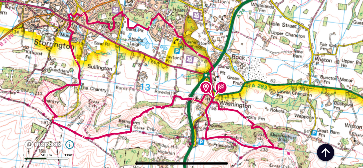 Day Walk – From WashingtonSaturday 2nd March 2024The walk is in two sections the first is 14km long from Washington up and west to Chantry, Storrington, Sullington Warren and Washington where you can finish the walk or in the Pub if you wish.Or some may wish to continue with me, the second loop to include Chanctonbury Ring, a further 5Km & 209m. So all please be ready to set off at 10:00 prompt. Please bring a packed lunch. Parking opposite the Frankland arms in Washington village, a turning off the A283; hopefully car sharing if possible as parking may be limited. Please let the organiser know if you intend to join us for this walk. Length of Walk:14km +(5km extra loop) Height Gain: 319m + (209m extra loop) |
| Organiser: Richard Wilton | email: |
| Grid reference: TQ 122 129 Post Code: RH20 4AL what3words: : ///compliant.headed.applause Coordinates: W 0.40487, N 50.9048
|
|
Day Walk – ArundelSunday 19th May 2024We'll meet at Mill Road car park at 9.45 for a 10am start. The car park is a 10 minute walk from Arundel rail station if coming by train.The walk follows the river Arun up past South Stoke then back down through Arundel Park. The route I have found is 7.11 miles with total ascent of 754ft of ascent. If the majority wishes there is a point hallway through the walk where we could decide to extend the walk to 10.9 miles in which case we would return through Rewell and Binsted wood then to the car park through the centre of Arundel. This extension would make the total ascent 933ft. Please let me know if you wish to attend. If you are able to offer a lift, or if you need a lift to attend please do let me know. |
| Organiser: Amber Benbow-Hart | email: |
| Grid reference: TQ 020 070 Post Code: BN18 9PA what3words: : ///avocado.paves.disbanded Coordinates: W 0.55143, N 50.8546
|
|